Showing posts with label charts. Show all posts

Monday, July 22, 2024

2023: Time Well Spent in St Martin

 AIS Coupler

We have had a GMC AIST120 coupler for some years and it works but not so well as I would have expected.  The antenna is mounted on top of the solar panel frames on the back of the boat and, I would have thought, send out a decent signal to the horizon.  On our Atlantic crossing from Portugal to Antigua, via Madeira, Canary and Cape Verde Islands, we found that some ships, on a heading to cross near us, would suddenly change course when only a couple of miles from us.  I concluded therefore, that we had not been picked up by them until they were relatively close.  So I decided to do something about it.

I purchased a GMC AISS120 coupler and installed it next to the VHF radio.  The idea is to use the VHF antenna for the radio, for the AIS too, as the VHF antenna is on top of the mast.  Much better range for obvious reasons.  You can’t use the VHF radio and the AIS at the same time but we hardly if ever use the VHF at sea so it didn’t matter.

The major challenge for WJ3 was to connect the AIS and the AIS coupler – the AIS is at the chart table and the VHF radio is on the port side of the companionway.  After looking at all options for the cable run, I ended up passing the cable from the AIS along the starboard side to the mast, then back under the ceiling liner to the coupler.  I needed about 40’ of cable rather than the 20’ I had initially purchased before I looked in detail at the routing options.  Fortunately it didn’t cost much but lesson learned again.  Time spent in detailed reconnaissance is seldom wasted.

The cable came with fittings which were supplied by a helpful salesman at Electec in St Marten.  Our elec techie Mike, who was working on a bunch of other elec issues (see below), soldered the fittings on the ends of the cable for me.  Next time I would look at a YouTube video as it didn’t seem particularly difficult when Mike showed me how I could do it myself.

Mike also supplied a ‘black box’ to link my Ipad with Navionics (located at the helm mostly) to the AIS via wifi.  Worked well in St Marten with symbols for each AIS/ship/boat shown on the chart but now in Trinidad having difficulties with it.  I’ll update as I progress and, if necessary, I’ll defer back to Mike via email.

New House Batteries

We found that our house batteries were not holding a charge very well.  As they were now six years old, plus we were experiencing all these charging problems, so it was time indeed to replace them whilst in St Marten.  We looked at the options and came up with four new Trojan 6 volt DC 225 to give total 450AH for USD 1066.  

Wednesday, February 13, 2019

2017 & 2108: Electronic Wizards. Perhaps Not...

Ongoing Saga: # 7

EPIRB Purchase.  I already have two EPIRBS – one PLB and a GME EPIRB, which had a battery that tested okey, but it was past the recommended change date.  So, I thought I should purchase a new one and decided to get an Australian one which would be automatically accepted by the Australian Maritime Authority (AMSA).  The GME was purchased in Oz and brought overseas with me years ago.  I only found that its battery was out of date when I arrived at the boat in Portugal.  

Anyway, I thought that importing a bit of safety gear into Portugal wouldn't be too much of a challenge.  I also understood that courier/shipment companies generally handled customs etc.  As things turned out my purchase was posted via the Oz Post Office which created all sorts of issues.  Firstly, although quickly despatched, it took almost two months to arrive at the boatyard, required a substantial customs payment, and the company that I ordered it from really didn’t show much interest.  I could not trace the item’s whereabouts on route.  The Oz Post Office I assume just send it on its way with no further interest, unlike UPS, DHL, FEDEX that I'd dealt with before.  The company even suggested that I follow up through the Portuguese Customs, which I eventually did once they contacted the boatyard to advise that the package had arrived in town nearby.  Any action beforehand would have been quite fruitless on my part due to being a foreigner, English speaking only, etc.

Once it finally arrived it should have been easy to register it with AMSA via the net but my registration was rejected because an EPIRB with my serial number had already been registered, believe it or not.  It took several phone calls to try to get AMSA to follow up.  Once again the company who sold me the EPIRB showed little interest and just referred me to the EPIRB manufacturer - kti.  By sending emails to both AMSA and kti the situation was eventually sorted.  My serial number WAS the correct one as it turned out and the other registered owner was contacted and provided the right serial number of their EPIRB.

In future if I am overseas and need to purchase another EPIRB, I'm likely to just purchase it where I can pick it up myself; although that has inherent registration issues.  Well, perhaps if my 10 year guarantee remains valid I might not need to.  (I doubt it as I anticipate that some new rule will be introduced soon requiring all current EPIRBS to be replaced in the next 2 years, although perhaps I am being a bit cynical in my old age).   Meanwhile, I have now have 3 EPIRBS, which all test okey.

VHF Handheld Radio.  The old one wouldn’t hold a charge so we purchased another while in the Canaries.

Sky Mate Antenna.  SkyMate is a satphone type comms gear which we installed 10 years ago.   It still operates so we decided that we would just renew our subscription as they advised that our old equipment is still okey but would be better if we upgraded with new equipment costing around 1000 USD or so.  We decided not to and subscribed so that we could use it and get used to using it again.  

Firstly, we had a number of problems with reception, and sending messages.  We contacted tech support, who it must be said worked very hard to solve our issues.  Things dramatically improved when I cleaned the antenna terminals and then moved the antenna away from other antennas and mounted it up on the framing that holds our solar panels above and behind the cockpit arch.  This was a major improvement and we thought it had solved all our problems.

Not quite!  As we were now using the equipment to get used to it but Microsoft (Windows 10) had other ideas.  It would not let us properly send and receive.  Microsoft would say indicate a problem and closed the Skymate.  We devised various ways to bypass and act quicker than Microsoft could hinder us so we got by with being able to send emails, mainly to report our position via message.  Eventually we exceeded our monthly allocation and our emails were rejected but this was fixed, again by tech support, who simply allowed the mails to be forwarded and billed us accordingly.    The fact that there was no notice to warn us we were approaching our limit is a major shortcoming of this equipment.  We were mid-Atlantic at the time and sending regular position reports to our blog.  We will certainly be considering alternate systems for future "blue water" use.

iPad.  My eldest son had given me an iPad and I love it.  Aside from the Kimble application (I do read a lot when sailing) it also takes Navionics charts, so I can have it in the cockpit with me.  The charts are especially useful when entering/leaving harbour.  With further use on the open ocean I found that I would not even bother to go down below to view the CMap chart on our laptop on the chart table.  The iPad Navionics is connected to a small Garmin Bluetooth GPS so that sits below sending signals to the iPad and I just turn it on every now and again to check progress.  So simple and easy to use.

I have even put together a small stand for it: a bamboo cutting board from a Chinese shop, and a clamp fitting that I screwed it to so that I could attach it to a handrail on the steering pedestal.  The iPad is held in place with a couple of small bungee cords.  It has been especially helpful while motoring along the US Intracoastal Waterway and far exceeds the CMap charts usability.  With Navionics you can zoom in and out to infinite settings – whatever is comfortable but zooming in is very important when navigating around channel markers in shallow shoaling waters.  CMap is extremely limited in this capacity; at least using it with the chart program Software on Board.

A couple of drawbacks, however.  While crossing the Atlantic - Cape Verde Islands to Antigua - a message came up from Apple that I needed to re-register and that I could do it from any place that I could access the web.  It locked up the iPad until I did and this all happened mid Atlantic.  Luckily we still had CMap which worked fine.  I wasn’t able to use Navionics again until I reached Antigua.  This is a very REAL safety issue.

Secondly, my iPad is in a waterproof plastic wallet so it is protected in the rain.  If the screen does get wet it will not function as a touch screen, just won’t do anything or will do very strange things so that it becomes unusable.  On one occasion on the ICW the rain was so fierce that I could not use the iPad (and I could hardly see to look for oncoming traffic) so I pulled over just out of the channel and dropped the anchor.  I’m sure there is a techie answer and I’ll put it in here when I find it.


We seem to be going in circles...

Thursday, March 3, 2016

2015: Going High Tech

iPad and GPS.  I'm not reporting on a breakage but a NEW toy.  For 2014 Christmas my eldest son gave me an iPad, a basic one but a lovely present nonetheless.  I added a waterproof case and a small Garmin GPS – the iPad and the GPS communicate via Blue Tooth.  We still use our laptop on the chart table below as the main nav system.  It’s a great system but, on occasion when you are entering harbour at night time for instance, it would be nice to have something in the cockpit so you don’t have to run up and down stairs frequently.  It’s not a big problem but now, we no longer need to do that .  We have the iPad in the cockpit! 

The iPad has Navionics which we down loaded from the Apple Store (app is free if I remember correctly) and then you download the charts that you want, in this case Europe, for a fee.   The GPS remains out of the way down below telling the iPad where we are via Blue Tooth.

Be careful, I ended up downloading the Caribbean charts too, completely unintentionally.  You can do this if you allow ‘one click’ purchase which I stupidly did thinking it would be more convenient in not having to re-enter information when making a number of purchases.  Well, I thought I was navigating around by pressing this and that but, as it turned out, I purchased a second set of charts.  Trap for (not so) young players.  Anyway, we’ll use the Carib charts eventually when we head back across the ‘pond’.
Anyway, the iPad in the cockpit is just so cool.  We even use it extensively as we just sail along to check on course, speed, etc – saves a trip downstairs.  I can’t speak more highly of this setup.

Another thing to bear in mind.  Unlike the CMap charts, which we have on our downstairs laptop and are loaded/unlocked from CDs/dongle mailed to you by CMap, the Navionics Charts are downloaded over the internet.  This takes some time as you have to download each chart one by one as you work your way along the coast in the area you intend to cruise.  Internet connection for data is essential for the downloading aspect, but otherwise it draws happily on the GPS. 

Fabulous solution - wished we'd done this earlier.  Trying to follow the river channel for nine hours up to Seville (Spain) springs to mind....


View from Castle of San Giovanni, Kotor, Montenegro - WJ3 on anchor

Friday, March 25, 2011

2008: British Virgins to Trinidad


Potters Bar on Anegada, BVI.  So!  Where are the lobsters? 
Work Completed Underway: Part 1

You would think that having worked solidly for two months in the BVI, there would be little left to do.  There's nothing like experience, so being on the water with sails hoisted or engine purring away highlighted one or two more little gaps in my workplan.  Many a truth is said in jest and Break Out Another Thousand is not too far from reality. 

The need to move on from the BVI was dictated by the weather….and insurance requirements, but WJ3 was now starting to take shape.  We did a little break-out cruise or two around the BVI, enjoying the clear waters and plentiful bars.  The BVI it seems is out to be hospitable to the large chartering fleets that nose about in every nook and cranny.  Despite large numbers of sail and motorboats on the water, picturesque bays remained accessible and there always seemed to be a spare mooring or more available if needed, and of course competent marinas.  However, I couldn’t in all honesty say that the government officials we reported to as we cleared in & out, were as friendly in dispensing their duty as many of the tradesmen and restaurant/bar staff we had come to know in our time there.
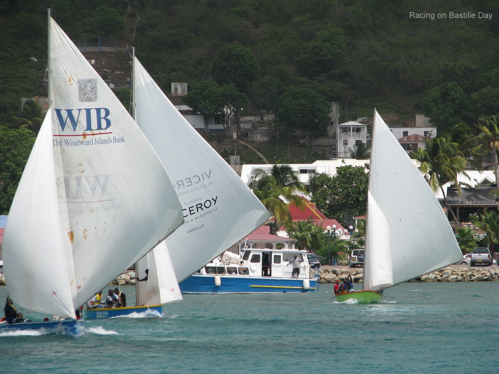
Local Racing Boats in Marigot Bay, St Martin 
Our first overnight sail involved getting from Anegada (BVI) to Marigot Bay, French St Martin across the much discussed (for all the wrong reasons) Anegada Passage.  A strong current pushed us slightly off course which added a few extra hours to our trip but that’s not too bad considering we didn’t have a GPS linked into our CMap charts.  Hourly readings on a hand-held GPS are for the birds!  Guess what one of the first things we did when we got to St Martin?  Yep, buy a BBQ!